
WHERE IS SELVÆR?

Here on the Helgeland coast - voted the most beautiful part of Norway - you will find Selvær, an island furthest north in the municipality of Træna.

About 110 km just south of Røst and 3-4 km north of the Arctic Circle you will find us. About 30 km out to sea, at the height of Mo i Rana and Svartisen, where you will find us
.

More about the grid can be found under BOAT. You can see Stokke Airport just south of Sandnessjøen.

NB For practical reasons, the distance between Sanna and Husøy in the south and the three islands to the north is considerably compressed. The distance Selvær - Husøy is 10-12 km. See correct distance conditions on the bottom map. This map you see above can be downloaded in pdf format. Klick here.

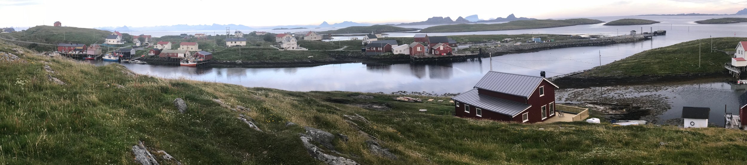
Selvær with buildings, roads and paths: The center of the circle is the speedboat quay. The longest hike is to the barbecue hut - a great vantage point and pleasant picnic area with shelter from the weather - which is located at the top of Nordsommarauken. That trip takes half an hour. NB! The medium blue fields around Selvær are all islets around us, and not deeper water layers.

Selvær is surrounded by islets and reefs. This island and island landscape is located on a plateau that is 5-10 meters below sea level, and which prevents the Norwegian Sea's most powerful swells from hitting us, even when the storms are at their worst.

Træna municipality with Sanna and Husøy in the south-west, you find bottom left. Selvær you will find twelve kilometers north, almost at the top of the map. Dørvær is called the islands south-south-east of Selvær. You see the ferry berth as a dotted line. In severe storms, the scheduled boats choose the "storm route" which is adapted to the wind conditions.